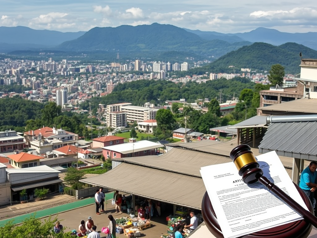
When Freedom of Contract Yields: Article 1306, Public Markets, and the Lessons from Baguio

The withdrawal of SM Prime Holdings from the proposed public market redevelopment in Baguio City has often been framed as a failed deal or a breakdown in negotiations. In truth, it offers a far more instructive lesson—one rooted in contract law, urban planning, and the statutory nature of public markets. It shows how freedom of contract, when confronted with planning policy and public welfare, is legally designed to yield.

At the center of this lesson is Article 1306 of the Civil Code, which enshrines freedom of contract but only within firm boundaries. Parties may stipulate as they see fit, but only so long as their agreements are not contrary to law, morals, good customs, public order, or public policy. This conditional structure matters greatly in contracts that affect public interest. Public market redevelopment is one such contract.

Public markets are not ordinary commercial properties. Under Section 17(b)(2)(viii) of the Local Government Code (RA 7160), public markets are expressly classified as basic services, on the same statutory footing as health and welfare facilities. This classification is decisive. Once an activity is defined as a basic service, it cannot be governed solely by profit logic or treated like a private mall. The law itself embeds a social function into the space.

The Local Government Code reinforces this social character through the general welfare clause in Section 16, which authorizes local governments to exercise police power to promote public welfare, social justice, and economic stability. This power includes regulating stall rentals, fees, access, and conditions of use in public markets—even when a private entity is involved through a public–private partnership. Sections 147 and 151 further authorize LGUs to impose reasonable fees and charges, a standard that is explicitly normative, not market-driven. Reasonableness is measured against livelihood capacity and public welfare, not revenue maximization.

When these statutory provisions are read together with Article 1306, the legal architecture becomes clear. Freedom of contract exists, but only within a planning and policy framework already defined by law. Contracts governing public markets are therefore not insulated private arrangements. They are subordinate to public policy as articulated in statutes, urban plans, and zoning ordinances.

In Baguio’s case, the public market has long functioned as a livelihood hub and cultural anchor. Planning objectives—affordability, protection of long-time vendors, and preservation of the market’s public character—were not incidental concerns raised late in the process. They are inherent in how the space is planned and governed. Once these planning constraints were asserted, the scope of permissible contractual discretion narrowed, exactly as Article 1306 anticipates.

From a legal standpoint, SM Prime’s withdrawal was not a failure of freedom of contract. It was a recognition of its limits. Article 1306 does not guarantee that a contract affecting public interest will remain commercially viable under all conditions. It guarantees only that parties may contract subject to existing and continuing public policy constraints. When those constraints—rooted in the Local Government Code and the city’s planning framework—made mall-type economics incompatible with the social function of the public market, withdrawal became the lawful and rational outcome.

This dynamic carries important implications for other cities contemplating similar redevelopments. In places like Cebu, where public markets are likewise embedded in CLUPs and governed by zoning ordinances, contracts cannot be used to bypass planning intent or displace intended beneficiaries through pricing and access mechanisms. Article 1306 ensures that contractual autonomy remains a tool for implementing urban policy, not a mechanism for undoing it.

Ultimately, the Baguio market episode affirms a principle that is often overlooked in infrastructure and redevelopment debates: not all urban spaces are meant to behave like malls. Public markets are planned spaces with statutory social functions. When private contracts collide with those functions, the law does not bend planning to contract. It bends contract to the plan. That is not an aberration in the legal system—it is the system working exactly as designed.

In this sense, the Baguio case demonstrates that Article 1306 does not guarantee the profitability or finality of a public-market contract. What it guarantees is a framework within which private agreement must remain aligned with law and public policy. When alignment becomes impossible—when the commercial model required by the private party cannot coexist with the social function of the public market—the legally correct outcome is not coercive enforcement, but withdrawal.

This dynamic is precisely why the Baguio withdrawal is instructive for other public market projects. It shows that contracts over public markets survive only if contractual autonomy serves, rather than defeats, livelihood, equity, and the common good. Article 1306 does not compel private parties to stay in such contracts at all costs; it simply ensures that they cannot insist on terms that override public policy. Where those terms are essential to the private party’s participation, exit becomes the lawful and rational option.

Seen this way, the Baguio market episode is not an anomaly. It is a practical manifestation of Article 1306’s deeper logic: freedom of contract exists, but in public-interest settings, it yields to social regulation—and when that yield is too great for commercial viability, withdrawal is the system working as designed, not failing.

How CLUPs and Zoning Ordinances Set the Real Limits of Freedom of Contract

Urban planning gives concrete institutional form to the limits that Article 1306 places on contractual autonomy, and this is most clearly expressed through the Comprehensive Land Use Plan (CLUP) and the Zoning Ordinance. These planning instruments are not merely technical documents; they are the local government’s formal articulation of public policy in space. When a contract concerns land or facilities governed by an approved CLUP and zoning ordinance, the contract does not operate above these instruments—it operates within them.

Under Philippine planning law and practice, the CLUP establishes the intended social, economic, and spatial function of land. Zoning then translates that intent into binding regulatory controls on use, intensity, and character of development. When a public market is designated in the CLUP as a civic, institutional, or special commercial use—particularly one oriented toward livelihood and public service—that designation carries legal consequences. It signals that the area is not meant to function as a purely market-driven commercial zone akin to a mall district. Instead, it is planned as livelihood infrastructure, embedded in the city’s social economy.

This is where Article 1306 and planning law converge. Article 1306 allows parties to stipulate freely, but only so long as those stipulations are not contrary to law or public policy. In the urban planning context, the CLUP and zoning ordinance are the most authoritative local expressions of public policy. A redevelopment contract that effectively transforms a public market—planned and zoned as a socially oriented urban facility—into a space governed by mall-type economics may comply with the text of the contract, yet still conflict with the CLUP’s planning intent. When that happens, Article 1306 ceases to protect contractual discretion and instead becomes the legal basis for regulation, recalibration, or even non-continuance of the agreement.

The Baguio public market episode illustrates this clearly. While the proposed contract with SM Prime Holdings may have been commercially sound, it ran into a planning reality grounded in Baguio City’s land-use objectives. The public market’s role in the city’s CLUP—as a livelihood hub, cultural space, and civic anchor—meant that zoning and planning policies necessarily imposed limits on rental structures, vendor displacement, and land-use intensity. Once the city asserted these planning constraints, the contract could no longer be treated as a purely private commercial arrangement. Under Article 1306, stipulations inconsistent with those planning objectives lost their normative force.

From an urban planning standpoint, this outcome is not accidental; it is structural. CLUP and zoning compliance function as ex ante filters on what kinds of contracts are viable in particular locations. They ensure that cities do not contract away their planning mandate through long-term agreements that lock in spatial outcomes contrary to adopted plans. Article 1306 provides the legal bridge that makes this possible by subordinating contractual freedom to public policy as expressed through planning instruments.

This has important implications for other cities contemplating public market redevelopment, including Cebu City. If the CLUP and zoning ordinance characterize Carbon Market as a public market, special commercial zone, or civic space with explicit livelihood and social functions, then any PPP or joint venture must be interpreted—and if necessary, regulated—through that planning lens. Contracts cannot be used to bypass zoning intent, intensify commercial use beyond what the CLUP envisions, or displace intended beneficiaries without violating public policy. When conflicts arise, Article 1306 does not protect the contract; it protects the plan.

In this sense, CLUP and zoning compliance are not secondary considerations that follow contract execution. They are preconditions that define the legal environment in which contracts operate. The Baguio withdrawal shows that when planning objectives are clear and consistently enforced, private parties make rational decisions: they either adapt their contractual expectations to the plan or withdraw. Both outcomes preserve the integrity of the planning system.

Ultimately, the lesson for urban governance is clear. Planning leads; contracts follow. Article 1306 ensures that freedom of contract remains a tool for implementing the CLUP, not a mechanism for undoing it. When cities take their planning instruments seriously, contractual autonomy aligns with urban policy—or yields to it.

Planning Is Preventive Law

By the end of 2025, one idea became clearer—not because it was new, but because it finally had a precise legal shape.

Years of working around land use, valuation, environmental constraints, and governance had already revealed a recurring pattern: disasters rarely begin with the event itself. They begin much earlier, quietly, through decisions that shape space, density, and exposure. What the Bar year did was not introduce this reality for the first time, but give it doctrinal clarity.

I came to understand that what we often treat as planning policy is, in truth, law operating in advance.


Planning is usually described in technical terms—maps, zoning colors, land-use matrices, projections stretching years into the future. Because of this, planning questions are often dismissed as administrative or premature, as if they sit outside the core concerns of law. Legal accountability, we are told, comes later—after damage, after injury, after loss.

But this way of thinking misunderstands what planning actually does.

Once a land use plan or zoning ordinance is adopted, it immediately produces legal effects. It authorizes certain uses, prohibits others, and—most importantly—determines where risk is allowed to exist. When residential use is permitted in flood-prone areas, exposure is not accidental. When development is allowed on unstable slopes, vulnerability is not unforeseen. When natural drainage paths are narrowed or built over, flooding is no longer a surprise.

These outcomes do not begin with nature.
They begin with decisions.


Planning as Preventive Law

Preventive law is not an unfamiliar concept. Building codes exist to prevent collapse. Fire regulations exist to prevent loss of life. Health and sanitation laws exist to prevent outbreaks. None of these wait for injury before they matter. Their legal force lies precisely in their ability to act before harm occurs.

Planning belongs to the same family of law, but it operates earlier and more quietly. It governs a stage where future occupants are unknown, where affected communities cannot yet assert their rights, and where consent to risk is rarely informed. That is exactly why the law requires planning to be rational, evidence-based, and compliant with statutory standards.

Seen this way, planning is not optional policy guidance.
It is a preventive legal duty.


The Legal Foundations Already Exist

This understanding is not theoretical. Philippine law already treats planning as a legally mandated function designed to prevent harm.

The 1987 Constitution, particularly Article II, Section 16, obliges the State to protect and advance the right of the people to a balanced and healthful ecology. This duty is preventive in nature. It does not wait for environmental collapse; it requires governance decisions that avoid it.

The Local Government Code (Republic Act No. 7160) reinforces this by vesting local governments with police power and the authority to enact zoning ordinances in the interest of public safety, health, and general welfare. Police power, by definition, is exercised to prevent harm—not merely to respond after the fact. Land-use regulation is one of its clearest preventive expressions.

The Urban Development and Housing Act (Republic Act No. 7279) explicitly requires rational land use and the avoidance of danger areas for human settlements. Allowing communities to be established or intensified in known hazard zones is therefore not just a planning lapse; it is a failure to comply with a statutory preventive mandate.

Environmental laws strengthen this framework. The Philippine Environmental Impact Statement System (Presidential Decree No. 1586) requires environmental impact assessment before project approval. The purpose of the EIA is not remediation but anticipation—to inform decisions so that environmental harm is avoided at the outset.

More recent legislation, such as the Climate Change Act (Republic Act No. 9729) and the Disaster Risk Reduction and Management Act (Republic Act No. 10121), explicitly require risk-informed and hazard-based planning. These laws translate scientific knowledge into legal obligation. Where climate and disaster risks are known or knowable, planning institutions are required to integrate them into land-use decisions.

With the enactment of the Philippine Ecosystem and Natural Capital Accounting System Act (Republic Act No. 11995), the preventive character of planning is made even clearer. By requiring the integration of natural capital considerations into policy and planning, the law recognizes that future environmental loss must be accounted for before decisions are made—not after damage is done.


What the Supreme Court Has Already Said—Implicitly

Philippine jurisprudence has long supported this preventive approach, even if the Court has not always used the term “preventive law.”

In Oposa v. Factoran, the Supreme Court recognized the right of present and future generations to a balanced and healthful ecology, allowing legal action to proceed even before irreversible harm had occurred. The case stands for the principle that environmental protection is anticipatory, not merely remedial.

In MMDA v. Concerned Residents of Manila Bay, the Court emphasized the State’s continuing obligation to protect and rehabilitate the environment. The duty recognized was not episodic or reactive; it was ongoing and proactive—consistent with the idea that governance failures upstream are legally relevant.

In Resident Marine Mammals v. Reyes, the Court applied the precautionary principle and underscored the importance of environmental compliance at the planning and approval stage. While framed in terms of precaution, the decision affirmed that legality is assessed before harm occurs.

Similarly, in West Tower Condominium Corp. v. First Philippine Industrial Corp., the Court focused on risk creation and foreseeability. The ruling made clear that where risk is foreseeable, and proximity exists, a duty arises—even before catastrophic damage fully unfolds.

Taken together, these cases show a consistent judicial posture: the law does not require disaster as a precondition for accountability. Where duty, foreseeability, and legal authority intersect, courts are prepared to intervene upstream.


Why Planning Is Not a Premature Legal Question

The argument that planning issues are “premature” usually rests on the absence of visible injury. But preventive law does not require collapsed homes or lost lives before it can be questioned. If it did, building codes, environmental clearances, and zoning regulations would only become relevant after failure—rendering prevention meaningless.

Once planning is mandated by law and formally adopted, a duty already exists. Once hazard maps, flood histories, and climate data are available, foreseeability already exists. And once plans authorize exposure to known risks, the legal issue is already present.

Damage does not create the breach.
Damage merely confirms what planning already allowed.


Planning, Climate Risk, and Accountability

Climate change has only sharpened this reality. Risk today is rarely uncertain. Flood pathways are mapped. Rainfall patterns are documented. Slope hazards are classified. Climate projections are publicly available. In legal terms, this means that discretion narrows and responsibility expands.

True adaptation does not mean learning to live with avoidable harm. It means adjusting plans, zoning, and land-use decisions so that foreseeable harm is not embedded into future development. Improving evacuation plans while allowing the same dangerous land uses is not adaptation; it is accommodation of failure.


A Closing Reflection

Understanding planning as preventive law changes how accountability is framed. Zoning maps become evidence, not background. Hazard studies become proof of foreseeability, not optional references. Planning approvals become legally reviewable acts, not purely political choices.

Justice should not begin with compensation after loss.
It should begin with decisions made when harm is still avoidable.

That is the perspective 2025 clarified for me—not as a new discovery, but as a consolidation of experience, doctrine, and observation. As we move forward in an era of climate risk, planning must be treated for what it truly is: the law’s first and most consequential opportunity to prevent harm.

Long before the waters rise, the law already has something to say.

Why the Issuance of the PENCAS IRR Is a Win for Lawful and Sustainable Planning

The recent issuance of the Implementing Rules and Regulations (IRR) of the Philippine Ecosystem and Natural Capital Accounting System (PENCAS) Act by the Department of Human Settlements and Urban Development (DHSUD) marks an important milestone for environmental governance and land-use planning in the Philippines. For those of us who have long argued that development planning must finally reckon with the real value of ecosystems, this moment is both a validation and a turning point.

But it is important to be clear about what this development means—and what it does not.

The IRR is not the beginning of PENCAS compliance. It is the formal operationalization of a legal obligation that already existed.

PENCAS Was Already Law Before the IRR

Republic Act No. 11995, or the PENCAS Act, was signed into law on May 22, 2024. By its own effectivity clause—Section 17—the law took effect fifteen days after publication. From that point on, the policy direction of the law was already binding on government agencies and local governments alike.

The IRR, ceremonially signed on May 22, 2025 and officially published on October 17, 2025, did not create the obligation to comply with PENCAS. It merely provided the technical guidance, standards, and institutional coordination mechanisms to ensure consistent and systematic implementation.

This distinction matters. In Philippine law, the absence—or later issuance—of an IRR does not suspend the effectivity of a statute. The law commands; the IRR explains how to comply.

Why This Matters for Land-Use Planning

Land-use plans, particularly Comprehensive Land Use Plans (CLUPs) and zoning ordinances, are not historical documents. They are forward-looking instruments that shape development decisions for decades. They authorize what can be built, where it can be built, and—just as importantly—what should not be built at all.

Once PENCAS became law, government planners were already required to recognize ecosystems and natural capital as economic assets, not externalities. At the very least, this meant avoiding irreversible land-use decisions affecting forests, watersheds, protected areas, and other ecologically critical systems without accounting for their value.

Total silence or omission is not compliance.

Why the Cebu City CLUP Raised Red Flags

It is against this legal backdrop that concerns were raised over the Cebu City CLUP 2023–2032 and its accompanying zoning ordinance.

On December 15, 2025, amid DHSUD’s ongoing review of the CLUP, I filed a formal notice and reservation of objection addressed to DHSUD Secretary Jose Ramon Aliling. The purpose was straightforward: to seek a formal review of the plan on the ground that it was not compliant with the provisions of the PENCAS Act.

As I explained in interviews, including to InsiderPH, the objection was filed to flag planning risks arising from the failure to integrate natural capital accounting into land-use decisions—particularly those affecting ecologically critical areas. These were not technical quibbles. They were questions of law.

The argument that PENCAS could not be applied because its IRR had not yet been issued was never convincing. The law was already in force. The CLUP was still under review, endorsement, and intended implementation. These are continuing governmental acts that must comply with the law in force at the time of decision.

What the IRR Changes—and What It Confirms

The issuance of the IRR removes any remaining ambiguity. It now provides planners and reviewing agencies with concrete tools, standards, and coordination frameworks for ecosystem and natural capital accounting.

More importantly, it confirms what should have been clear from the start: that PENCAS is meant to be integrated into planning and decision-making, including CLUP review and approval. The IRR does not reset the clock. It strengthens the obligation.

For CLUPs and zoning ordinances that are still pending approval, refinement, or implementation, the path forward is now unmistakable. Compliance with PENCAS is no longer debatable—legally, administratively, or morally.

A Win for Law, Not a Loss for Development

This moment should not be framed as anti-development. On the contrary, it is a win for lawful, science-based, and future-oriented planning.

Development that ignores ecosystem value is not efficient; it is deferred cost. Flooding, landslides, water scarcity, and climate vulnerability are the downstream consequences of planning that treats nature as expendable. PENCAS simply asks us to account for what we have long taken for granted.

By issuing the IRR, DHSUD has taken a critical step toward aligning land-use planning with ecological reality. The next step is ensuring that pending and future plans—especially those governing highly urbanized and environmentally sensitive areas—are realigned accordingly.

Looking Forward

The challenge now is implementation with integrity. PENCAS should not be reduced to a box-ticking exercise or an annex buried in technical volumes. It must inform zoning decisions, constrain risky land conversions, and reshape how we define “development success.”

If this happens, then the issuance of the PENCAS IRR will not just be a bureaucratic milestone. It will be remembered as the moment when planning finally caught up with law, science, and common sense.

And that is a win worth declaring.

Green on Paper, Wet on the Ground: How Multiple-Use Zoning Shapes Cebu’s Flood Risk

The Cebu City Comprehensive Land Use Plan (CLUP) 2023–2032 is often defended on the ground that it significantly expands environmental protection because more than half of the city is now classified under the National Integrated Protected Areas System (NIPAS) Central Cebu Protected Landscape. On paper, the figures appear impressive. Forest land drops from 9,312.31 hectares, or 31.08 percent of the city’s land area in 2020, to just 2,892.91 hectares, or 9.65 percent, while a new category—NIPAS CCPL—suddenly expands to 15,102.10 hectares, or 50.40 percent. At first glance, this seems to suggest that forest loss has been offset by a dramatic increase in protected area coverage. In reality, this shift is largely a reclassification, not a conservation gain.

Forest Reduction and NIPAS CCPL Expansion under the Cebu City CLUP (2020 vs. 2023–2032)

Land Use Category2020 Area (ha)2020 Share of City (%)2023–2032 Area (ha)2023–2032 Share of City (%)Change (ha)Change (percentage points)
Forest9,312.3131.08%2,892.919.65%–6,419.40–21.43 pp
NIPAS CCPL15,102.1050.40%+15,102.10+50.40 pp

The crucial detail lies in how the NIPAS CCPL is treated internally under the CLUP and its implementing zoning ordinance. The protected landscape is not governed as a single protection category. It is subdivided into Strict Protection Sub-Zones and Multiple-Use Zones. These two sub-zones have radically different legal and ecological effects, yet they are collapsed into a single “NIPAS CCPL” figure in the comparative land-use table. This aggregation creates the impression of expanded protection while concealing a fundamental change in how large portions of the uplands are actually regulated.

Strict Protection Sub-Zones are designed to keep ecosystems intact. They prohibit roads, structures, utilities, and settlement, allowing only limited scientific or educational activity. By contrast, Multiple-Use Zones explicitly allow settlement, agriculture, agroforestry, infrastructure, utilities, livelihood activities, and even extractive uses, subject to conditions, variances, and environmental impact assessments. In practical terms, strict protection constrains development, while multiple use manages development. Treating both as equivalent under a single “protected area” label obscures this distinction.

The land-use data strongly suggest that much of what was previously classified simply as forest in 2020 did not become strictly protected. Instead, it was absorbed into the NIPAS CCPL category and then zoned as Multiple-Use Zone. Only a smaller core—typically the most intact, high-elevation, and least accessible forest blocks—could realistically have been placed under strict protection. Areas closer to barangays, with existing settlements, road access, or development pressure, could not have been placed in strict protection and were therefore zoned as multiple use. This includes large portions of the former forest cover at the urban–upland interface.

This permissive framework is further reinforced by the city ordinance’s treatment of socialized housing within the Multiple-Use Zone. Even within the protected landscape, the zoning ordinance allows socialized housing projects to proceed if they are deemed “essential” and are claimed to have minimal environmental impact. In such cases, the proponent is required to seek variances and exceptions from the Zoning Board, supported by an Environmental Impact Assessment and an Environmental Impact Statement, which must be presented prior to the issuance of an Environmental Compliance Certificate by the DENR–Environmental Management Bureau. The project must also be certified by the Department of Human Settlements and Urban Development as a socialized housing project. Where granted special authorization, development is limited to single-detached units on lots of at least 64 square meters and a maximum building height of seven meters.

While these conditions appear restrictive on paper, they underscore the deeper structural issue: land that is otherwise acknowledged as ecologically sensitive and disaster-prone is rendered negotiable through administrative discretion. The safeguards operate at the project level, not at the landscape or watershed level. They assume that environmental risk can be mitigated case by case, rather than avoided altogether through strict land-use exclusion. In a steep, erosion-prone watershed, even low-rise, low-density housing introduces roads, slope cuts, drainage alteration, and cumulative runoff effects that no project-specific EIA can fully neutralize. In this sense, the socialized housing exception does not soften the impact of Multiple-Use Zones—it institutionalizes it.

What Necessarily Went Into Multiple-Use Zones (MUZ)

MUZ is the only CCPL sub-zone where the zoning ordinance allows:

  • settlement and relocation sites,
  • agriculture and agroforestry,
  • infrastructure and utilities,
  • agro-industrial activities,
  • sale and disposition of titled land,
  • and even sand and gravel extraction, subject to EIA.

As a result, any part of the CCPL that:

  • already had settlements,
  • lay adjacent to barangays,
  • had road access,
  • or was earmarked for housing, utilities, or livelihood expansion,

could not have been placed in SPZ and was almost certainly zoned as MUZ.

The CLUP zoning maps explicitly identify CCPL Multiple-Use Zones (MUZ) in at least 22 upland barangays, including Adlawon, Agsungot, Babag, Buhisan, Guba, Sirao, Sudlon I and II, Tabunan, Taptap, Toong, and others. These are not peripheral areas. They are headwaters, slopes, and watershed interfaces directly influencing river systems that drain into Cebu City’s urban core.

Functionally, this represents a downgrade in protection. Forest converted into strict protection retains its hydrological and ecological role. Forest converted into a multiple-use zone does not. Even if development is limited to 30 percent of the land area, that 30 percent often consists of roads, access cuts, building pads, and slope modification. These interventions fragment the remaining vegetation, reduce infiltration, increase runoff velocity, destabilize slopes, and raise sediment loads. Hydrologically, a multiple-use zone does not behave like a forest. The correct comparison, therefore, is not forest versus NIPAS, but forest and strict protection versus multiple use. Measured this way, the CLUP reflects a net weakening of upland and watershed protection.

This matters because the uplands of Central Cebu are not just scenic backdrops. They are natural flood infrastructure. Forested slopes slow rainfall, store water, stabilize soils, and regulate downstream flows. When zoning allows these functions to be negotiated away through settlement, roads, utilities, and extractive activities, flood risk is displaced downhill. The cost is borne by lowland communities that experience more frequent and more severe flooding, even as upland development is justified as “controlled” or “sustainable.”

The zoning ordinance itself makes the contrast unmistakable. In the Strict Protection Sub-Zone (SPZ), the City recognizes that certain upland areas must be treated as non-negotiable ecological infrastructure: no roads, no utilities, no structures, and no human activity beyond science and education, precisely because these areas are highly erodible, disaster-prone, and critical for soil, water, and flood regulation. Yet within the same protected landscape, the Multiple-Use Zone (MUZ) operates on the opposite logic. It allows settlement, roads, utilities, land disposition, and even extraction—subject only to conditions and approvals—on the premise that environmental risk can be managed rather than avoided. The contradiction is stark: SPZ accepts that some areas must be left alone to reduce flooding and disaster risk, while MUZ assumes that development in equally sensitive upland watersheds can be negotiated without consequence. Floodwaters, however, do not distinguish between zones. What is permitted in MUZ ultimately undermines what SPZ is meant to protect.

Question of Legal Authority

There is also a legal dimension to this shift that is often overlooked. NIPAS allows multiple-use zones only to the extent prescribed in the Protected Area Management Plan approved by the Protected Area Management Board. Local governments are required to align their plans with these prescriptions, not replace them with their own discretionary zoning regimes. By defining allowable uses, authorizing variances, and substituting zoning-board discretion and project-level environmental assessments for management-plan limits, the ordinance exceeds the authority delegated to the city under national law. In legal terms, this is an ultra vires act—an exercise of power beyond what the law allows. Environmental compliance certificates and impact assessments cannot cure this defect, because procedural safeguards do not legalize land-use policies that are unlawful at their core.

The implications extend beyond technical planning debates. When a land-use plan presents an apparent expansion of protected areas while quietly converting large portions of former forest into multiple-use zones, it creates an illusion of environmental progress. The label changes, but the watershed function deteriorates. In a city repeatedly hit by flooding, this distinction is not academic. It is the difference between treating the uplands as non-negotiable ecological infrastructure and treating them as a managed development frontier.

Ultimately, the question is not whether development should occur in Cebu, but where, how, and under whose authority. When forest protection is diluted under the banner of multiple use, the consequences do not stay in the uplands. They flow, quite literally, downhill.

A Welcome Pause — But One That Exposes a Deeper Contradiction

The recent announcement of a moratorium on upland development is, at first glance, a welcome development. It signals an overdue recognition that what happens in the uplands does not remain confined there. Upland activities—slope cutting, land conversion, quarrying, and hillside construction—directly affect runoff, sedimentation, and flood risk downstream. After years of recurring floods, this acknowledgment matters.

But a pause alone is not the same as reform. And taken together with the current planning situation, the moratorium exposes a serious institutional contradiction that cannot be ignored.

At present, the Cebu City Comprehensive Land Use Plan and Zoning Ordinance (CLUP–ZO) 2023–2032 remains pending review and approval by the Department of Human Settlements and Urban Development (DHSUD). This is important. A CLUP is supposed to be the city’s definitive spatial framework—one that integrates land use, environmental constraints, hazard data, and long-term development direction.

Declaring a moratorium while allowing the CLUP to continue through the approval process sends mixed signals. On one hand, the City is saying that upland development policies, zoning ordinances, and risk assessments require comprehensive review. On the other, it is permitting a plan—prepared under those same assumptions—to move forward as if those concerns did not exist.

These two positions are institutionally inconsistent.

A moratorium is not merely a pause in permitting; it is an implicit admission that something in the existing planning framework is flawed or incomplete. Allowing the CLUP–ZO to proceed while simultaneously questioning its foundations risks locking in the very policies now being reconsidered. If the review is serious, the planning document built on those policies cannot be treated as settled.

More importantly, the value of the moratorium will depend entirely on what happens during the pause.

A meaningful review must go beyond surface-level policy checks or inventorying existing regulations. It must confront the structural causes of flooding, which did not arise overnight. This includes revisiting historical zoning amendments enacted without adequate technical studies, particularly those that incrementally intensified upland development. It also requires a cumulative assessment of upland impacts on downstream flooding, rather than treating each project or permit as an isolated case.

For decades, zoning decisions were often made in fragments—project by project, amendment by amendment—without basin-wide hydrological analysis or long-term carrying capacity studies. The downstream consequences of those decisions are now visible in flood-prone communities. Any review that fails to reckon with this history risks becoming procedural rather than corrective.

Finally, all findings from the moratorium review must be anchored to an EO 72–compliant Comprehensive Land Use Plan. Executive Order No. 72 was designed precisely to prevent piecemeal land-use decisions by requiring that zoning be subordinate to a comprehensive, technically grounded plan. Flood risk, hazard exposure, and environmental limits must be integrated at the CLUP level—not appended as afterthoughts.

If the moratorium results in a genuine reassessment of upland policies, a review of past zoning decisions, and meaningful revisions to the CLUP before it is resubmitted for approval, then the pause will have served its purpose.

If not, the moratorium risks becoming a symbolic gesture—a temporary halt that leaves the underlying planning framework unchanged, while flood risks continue to accumulate downstream.

A pause is welcome.
But integrity in planning demands consistency, accountability, and correction—not just restraint.

A Brief Context: Years of Zoning Without a Comprehensive Plan

To understand why the moratorium has become necessary, it helps to revisit how Cebu’s land-use rules evolved.

For much of the past three decades, zoning ordinances and amendments moved ahead in the absence of a fully EO 72–compliant Comprehensive Land Use Plan (CLUP). Instead of zoning being the implementing tool of a comprehensive plan, the process was effectively reversed: zoning became the primary mechanism through which land-use decisions were made.

Beginning with the 1996 Zoning Ordinance, and continuing through numerous subsequent amendments, land-use classifications were adjusted incrementally—often in response to specific proposals, developments, or economic pressures. These amendments were typically stand-alone actions, not products of basin-wide hydrological studies, cumulative flood modeling, or carrying-capacity analysis.

Over time, this resulted in:

  • Incremental intensification of upland and slope areas, approved project by project;
  • Fragmented land-use decisions, evaluated individually rather than cumulatively;
  • Absence of technical backup studies linking upland approvals to downstream flood risk.

Each amendment, taken alone, may have appeared manageable. But collectively, they reshaped watersheds, increased surface runoff, and weakened natural flood-regulating functions—without those impacts ever being fully measured or accounted for.

The flood overlay zones now reflected in the CLUP 2023–2032 are, in many ways, a delayed recognition of this history. They acknowledge risks that accumulated gradually through years of zoning decisions made without a unifying, science-based framework.

Seen against this backdrop, the current moratorium is not a sudden shift in policy. It is a corrective response to a long period of planning through amendments rather than through a comprehensive, EO 72–compliant CLUP.

Bringing PENCAS to Cebu: A Legal Challenge to the City’s New Land Use Plan

Environmental planner and economist Gus Agosto has taken a significant step in Cebu City’s ongoing land‑use debates by filing a formal notice and reservation of objection with the Department of Human Settlements and Urban Development (DHSUD). The notice focuses on the review of the Cebu City Comprehensive Land Use Plan (CLUP) 2023–2032 and raises an issue that has been largely absent from local public discussion: compliance with the Philippine Ecosystem and Natural Capital Accounting System (PENCAS) Act, or Republic Act No. 11995, and its Implementing Rules and Regulations.

At the heart of the filing is a simple but powerful question: can Cebu City still afford to plan growth as if its ecosystems, watersheds, and floodplains are external to the economy? For Agosto, the clear answer is no. RA 11995 declares that “natural capital” – including land, ecosystems, and the services they provide – is a measurable economic asset of the State and its political subdivisions. This is not a mere policy preference. Under PENCAS, natural capital accounting must be integrated into planning and decision‑making, particularly where long‑term land use, infrastructure, and public‑private partnerships are involved. In practice, this means a CLUP can no longer be just a map of zones and a bundle of sectoral plans; it must demonstrate how land‑use allocations respect ecological thresholds, risk patterns, and the economic value of environmental services.

The Cebu City CLUP 2023–2032, as currently framed, does many things right on paper. It outlines sectoral strategies for housing, commerce, industry, transport, and water supply. It references hazard maps and acknowledges flooding and slope risks. But, as Agosto points out, these elements remain largely compartmentalized. The plan stops short of weaving them into a cohesive, risk‑sensitive spatial strategy that clearly shows how development is constrained by carrying capacity, hazard exposure, and environmental limits. The result is a document that appears procedurally complete—boxes ticked, chapters present—but substantively misaligned with the integrated, law‑driven planning model now required under Executive Order No. 72, DHSUD’s own guidelines, and PENCAS.

This critique matters because Cebu City is not planning on a blank slate. It is a dense, highly constrained urban area, bounded by steep uplands and a vulnerable coastline, with a well‑documented history of flooding, traffic bottlenecks, and informal settlements on marginal land. In such a context, “sectoral” planning without genuine spatial integration is not a minor technical flaw; it can translate into very real, very costly risks for communities. If new commercial or residential intensities are allowed in upland or mid‑slope areas without full accounting of downstream flood impacts, the city effectively subsidizes risk—transferring the costs to low‑lying barangays that will experience deeper and more frequent inundation.

PENCAS adds another layer. By requiring natural capital accounting, RA 11995 insists that decisions about where to build, what to conserve, and how to structure public‑private partnerships must be informed by quantified assessments of ecosystem services and environmental limits. Watersheds, coastal zones, and floodplains do not merely host development; they regulate water flows, buffer storms, and sustain fisheries and livelihoods. When these are degraded or overbuilt, the “loss” is not just aesthetic or ecological—it is economic, measurable in damage to infrastructure, loss of productive days, and increased public spending on disaster response. Natural capital accounting is a way of making these hidden costs visible before, not after, decisions are taken.

Agosto’s filing is also a reminder of DHSUD’s central role in ensuring that local planning complies with national law. Executive Order No. 72 designates the CLUP as the primary basis for zoning, infrastructure provision, and land development decisions, and gives national agencies like DHSUD the responsibility to review local plans for conformity with national standards. With PENCAS already in effect, DHSUD is now expected not only to check format and basic legal compliance, but to ask whether plans show evidence of natural capital accounting: have ecosystems been valued, thresholds identified, and risks internalized into zoning and land‑use regulations? Approving a CLUP that treats PENCAS as optional would weaken the law at precisely the moment it is meant to change planning practice on the ground.

Crucially, the notice is not framed as an attempt to stop development or to delegitimize Cebu City’s efforts to adopt a long‑term land‑use plan. Instead, it positions itself as a rights‑based and policy‑grounded reminder to strengthen the CLUP. Agosto emphasizes that the objective is to align Cebu’s growth strategy with three converging realities: the legal obligations under RA 11995 and EO 72, the ecological constraints of a flood‑ and hazard‑prone city, and the long‑term public welfare of residents who will live with the consequences of today’s zoning maps and infrastructure decisions. In other words, the call is not “no development,” but “no development that pretends nature and risk do not count.”

For local stakeholders, planners, and advocates, this intervention offers a preview of what the PENCAS era will look like in practice. Formal plans, joint ventures, and big‑ticket infrastructure will increasingly be assessed not only on their financial terms and engineering feasibility, but also on whether they recognize natural capital as part of the economic equation. Cebu City’s CLUP review is an early and important test case. Whether DHSUD chooses to treat Agosto’s filing as a technical annoyance or as an opportunity to put PENCAS into meaningful operation will say much about the future of urban planning and environmental governance in the Philippines.

Environmental Rights Are Human Rights: Why Cebu Must Defend Its Constitutional Right to a Balanced and Healthful Ecology

HUMAN RIGHTS DAY MESSAGE

Today, the world commemorates International Human Rights Day, marking the anniversary of the Universal Declaration of Human Rights.

But in Cebu, this day carries a deeper, more urgent meaning. In our island—where critical watersheds are shrinking, fragile slopes are carved for profit, rivers are choked with silt, and communities drown in entirely preventable floods—one fundamental human right is under unprecedented threat:

The Right to a Balanced and Healthful Ecology.

This is not a political slogan or an aspirational ideal. It is a constitutional mandate, enshrined in Article II, Section 16 of the 1987 Philippine Constitution:

“The State shall protect and advance the right of the people to a balanced and healthful ecology in accord with the rhythm and harmony of nature.”

This right is further affirmed by the Supreme Court in the landmark case of Oposa v. Factoran (1993), which established that environmental rights are intergenerational, enforceable in court, and impose a mandatory duty on all government officials to protect the environment for present and future generations.


I. Environmental Neglect is a Human Rights Violation

Human Rights are not solely civil and political; they are inextricably environmental, social, and economic.

Cebuanos cannot fully enjoy their right to life, security, livelihood, or safe housing if their communities are systematically placed in harm’s way by governance failures, including:

  • Scientifically unsound land-use decisions.
  • Approval of upland developments in known hazard-prone areas.
  • Zoning ordinances that ignore hydrological and watershed limits.
  • Failure to integrate mandatory hazard maps and natural capital accounting.
  • Non-compliance with national laws such as RA 11995 (PENCAS) and RA 11038 (E-NIPAS).

When a city tolerates policies that exacerbate climate risks and disaster intensity, the resulting flooding and landslides cease to be “natural disasters.” They become human rights violations caused by official negligence, abuse of authority, and systemic disregard for public safety.

The government, by transferring disaster risk from developers and decision-makers onto the most vulnerable communities, violates the people’s constitutional right to: Health, Security, Safety, Due Process, Life, and Environmental Equity.


II. The Human Cost of Environmental Injustice in Cebu

Recent disasters, such as the flash floods caused by Typhoon Tino and similar weather events, tragically revealed the truth Cebuanos have felt for years: Catastrophic flooding is not inevitable. It is the direct consequence of human decisions—of upland reclassification, politically influenced zoning, weak enforcement, and the dangerous disregard for the island’s carrying capacity.

In areas like Bacayan, Mananga, Compostela, and Subangdaku, lives have been lost, homes destroyed, and families displaced. These are not isolated tragedies. They are symptoms of a profound governance failure, violating both the tenets of environmental protection and the principles of social justice.


III. Accountability Mandated by Law: The PENCAS Defect

The law requires more from our leaders, particularly following the enactment of the Philippine Ecosystem and Natural Capital Accounting System Act (RA 11995).

PENCAS, effective in May 2024, made it mandatory for all government units to:

  • Integrate natural capital valuation in all planning.
  • Consider ecological thresholds before approving developments.
  • Quantify environmental losses and risks to protect critical ecosystems.

However, the recently approved Cebu City CLUP and Zoning Ordinance 2025—passed after PENCAS took effect—demonstrates an alarming failure to integrate these mandatory principles.

This is not only a profound legal defect but, more importantly, a human rights crisis. When planning willfully ignores ecological science and mandatory laws, the people ultimately pay the price with their lives, homes, and livelihoods.


IV. Environmental Justice is Human Rights Justice

The Constitution demands “harmony with nature.” Conversely, our current planning trajectory is in direct conflict with nature.

Scientific data consistently shows that the uplands contribute 55–60% of Cebu’s floodwater runoff. Yet, land-use decisions continue to open these crucial slopes and midlands to:

  • Excessive reclassification and rezoning.
  • Expansive subdivisions and commercial sprawl.
  • Aggressive road cuts and quarrying.

This pattern is not development; it is risk accumulation. Every time a watershed is weakened, a slope is destabilized, or a flood basin is paved over, we fundamentally undermine the people’s rights to safety and a sustainable future.

Environmental Justice demands that:

  • Those who benefit from development must not be allowed to inflict harm on those downstream.
  • Government decisions must be based on science and must not endanger the public they swore to protect.
  • Vulnerable communities must not be sacrificed for private gain and political expediency.

V. A Call for Action and Accountability

On this International Human Rights Day, we stand together to assert that:

  • Flood safety is a Human Right.
  • Compliance with environmental law (RA 11995) is a mandatory duty.
  • Hazard-informed planning is a legal requirement.
  • No zoning ordinance should contradict science, and no public official has the authority to gamble with ecological security.

We assert our right to demand accountability, transparency, correction of defective plans, and the unwavering protection of our uplands and watersheds.

We look forward to A Cebu That Honors Human Rights: a city built on the right to safe communities, flood resilience, and ecological integrity.

Environmental Rights ARE Human Rights. Justice for Cebu.

LEGALESE

Why the CLUP Cannot Be Overridden by a Simple Ordinance

In conversations about Cebu City’s development, one dangerous misconception keeps circulating:

“The CLUP is just a tool. The City Council can always pass a new ordinance to change it.”

This idea is not only false —
it is illegal, misleading, and destructive to long-term planning.

The CLUP is not a casual instrument.
It is the foundation of the city’s entire land-use system, backed by national law, Supreme Court jurisprudence, and technical standards.

This explainer breaks down, in clear language, why the CLUP cannot be casually altered, and why it must remain the city’s controlling land-use document.


1. The CLUP Is a Legal Mandate — Not an Optional Planning Tool

The Local Government Code (RA 7160) is explicit:

“Local government units SHALL prepare their comprehensive land use plans…
which SHALL be the PRIMARY and DOMINANT bases for land use.”

(Sec. 20, RA 7160)

Let’s unpack this:

✔ “SHALL” — means mandatory, not optional

✔ “PRIMARY and DOMINANT” — means superior to all land-use ordinances

✔ “Bases for land use” — means all zoning and land decisions MUST follow it

The CLUP is NOT:

  • a guideline
  • an advisory document
  • a flexible policy tool

It is a statutory requirement and it shapes every land-use decision the city makes.


2. The CLUP Is Approved by National Agencies — So a Simple Ordinance Cannot Override It

Under Executive Order 72 and DHSUD/HLURB Rules, the CLUP must pass through:

  1. Technical planning
  2. Public consultations
  3. CPDO review
  4. City Council adoption
  5. Regional Land Use Committee (RLUC) approval
  6. NEDA oversight

This makes the CLUP part of the national planning system.

A regular ordinance:

  • does not undergo national review
  • does not pass through RLUC
  • does not require technical studies
  • is not evaluated for hazards, transport, drainage, or environmental impact

Therefore:

A local ordinance cannot overrule a document that required multi-level approval.

The CLUP is a nationally aligned, technically vetted plan.
A zoning amendment is not.


3. The Zoning Ordinance (ZO) Is Only Valid if It Conforms to the CLUP

This is often misunderstood.

The Zoning Ordinance is the implementing arm of the CLUP.
It cannot contradict the CLUP — it must FOLLOW it.

The Supreme Court has said this in black-and-white:

A. Rizal v. Mandaluyong (2005)

Zoning must conform to the CLUP; otherwise, the ordinance is invalid.

B. Fernando v. St. Scholastica’s (2008)

Any deviation from the CLUP requires a CLUP amendment FIRST.

C. Hacienda Luisita v. DAR (2011)

Land-use changes must be consistent with the approved CLUP.

These rulings make one thing clear:

A zoning ordinance that contradicts the CLUP is illegal and void.

So the common LGU practice of “rezoning by ordinance” without CLUP amendment is contrary to law.


4. The CLUP Protects Cebuanos Against Dangerous, Arbitrary, or Politically Driven Land-Use Changes

This is the purpose of having a legally binding CLUP.

Without a strong CLUP:

  • developers can lobby for spot zoning
  • upland areas can be converted illegally
  • floodplains can be reclassified as commercial
  • hazard zones can be opened for construction
  • transport systems lose their logic
  • water supply planning collapses
  • disaster risk increases
  • the environment becomes negotiable

The CLUP ensures decisions are based on:

  • science
  • terrain
  • hazard maps
  • environmental limits
  • water capacity
  • transport systems
  • long-term growth

—not political influence.

A casual ordinance bypasses all of these safeguards.


5. Changing the CLUP Requires a Full, Regulated Amendment Process — Not a Shortcut

Can the CLUP be amended?
YES — but only through a formal, technical process, not by a simple ordinance.

CLUP amendments require:

  • updated technical studies
  • barangay consultations
  • environmental and hazard assessments
  • CPDO evaluation
  • Sanggunian approval
  • DHSUD regional approval
  • RLUC/NEDA conformity

That takes months, sometimes years.

A zoning ordinance alone takes a few weeks —
which is why some LGUs prefer shortcuts.

But these shortcuts are illegal and expose the city to legal, environmental, and governance risks.


6. The CLUP Has Constitutional Weight

The 1987 Constitution guarantees:

“The right to a balanced and healthful ecology.”
(Art II Sec 16)

Land use planning is one of the main instruments used by LGUs to fulfill this constitutional mandate.

If officials bypass, ignore, or override the CLUP, they violate:

  • Constitutional policy
  • Environmental safety
  • National planning standards
  • Due process
  • Risk reduction principles

This is why the CLUP is not a tool —
it is a constitutional obligation.


7. What Happens If Cebu Treats the CLUP as “Just a Tool”?

The consequences are immediate and severe:

✔ legally void zoning ordinances

✔ invalid permits

✔ increased liability for LGU officials

✔ misaligned infrastructure

✔ worsening flooding

✔ unregulated upland development

✔ breakdown of transport logic

✔ worsening housing crisis

✔ environmental degradation

✔ higher disaster risk

Cebu City cannot afford these outcomes —
not with its limited land, growing population, and worsening climate hazards.


The CLUP Is the City’s Land-Use Constitution

It is:

  • mandated by national law
  • affirmed by the Supreme Court
  • integrated with national planning bodies
  • approved through RLUC
  • the basis of zoning
  • the backbone of environmental protection
  • the anchor of water, transport, and infrastructure planning
  • the legal safeguard against arbitrary land-use decisions

When officials say:

“We can override the CLUP with a new ordinance,”

they are misunderstanding —
or ignoring —
the entire Philippine land-use legal system.

Cebu deserves better.
Cebu deserves planning grounded in law, science, and long-term vision —
not shortcuts.

CLUP/ZO SERIES – PART 1

Why Cebu City’s Housing Plan Cannot Work: A Critical Look at the CLUP’s Most Serious Weakness

This article begins my multi-part series on Cebu City’s new Comprehensive Land Use Plan (CLUP) and Zoning Ordinance (ZO).
Over the next few weeks, we will look closely at what this plan gets right, what it gets wrong, and how its flaws shape Cebu’s future — for better or for worse.

We begin with the sector that affects all others: HOUSING.

Because where people live determines how they move, how they work, how communities grow, and ultimately whether a city becomes livable — or collapses under its own weight.

And right now, Cebu City’s housing plan is on the wrong path.


The Huge Gap Between Housing Needs and Housing Reality

The City estimates that 865,725 housing units are needed to address the backlog and future demand.
To accommodate that number, the CLUP calculates that Cebu City would need 15,169 hectares of additional residential land.

But here is the problem:

Cebu City does not have 15,169 hectares of buildable land.

It doesn’t even come close.

Cebu is not a flat province like Cavite or Laguna.
It is a mountain city with narrow slopes, rivers, steep terrain, coastal hazards, and protected watersheds.

Only about 25–30% of Cebu’s total land is actually suitable for safe residential development.

In other words:

The very formula used to compute Cebu’s housing demand does not fit Cebu’s geography.

It’s like measuring a mountain with a ruler designed for plains.

And because the method is wrong, the strategies that follow also fall apart.


So Where Will Cebu Build? The CLUP’s Answer: SRP

Because Cebu lacks large, flat, safe tracts of land, the CLUP turns almost entirely to the South Road Properties (SRP) — a reclaimed area exposed to storm surge, subsidence, and liquefaction — as the primary relocation site for the urban poor.

The City actually owns 313 hectares of land across 211 parcels.
But a massive 240 hectares (76%) of this land is in SRP.

This explains the CLUP’s insistence on building:

  • Temporary housing in SRP
  • Permanent high-rise housing in SRP
  • Social housing clusters in SRP

SRP is the easiest to access politically.
But it is also one of the most dangerous places to house the poor.

Relocating families from riverbanks and hazard zones only to place them in a coastal hazard zone is not progress — it is risk transfer.

It moves people out of danger… and into another kind of danger.


The “Permanent Housing” Plan Is Even Harder to Believe

The CLUP describes an ambitious “South Coastal Urban Development” (SCUD) project:

  • 5-storey, 10-storey, and 20-storey MRBs
  • Long-term leases “like Singapore”
  • Thousands of families relocated to high-density towers

But the proposed site is still underwater.
The land does not exist yet — it must be reclaimed first.

Even if the concept is good, the location and timing are not.

It will take years before the land is ready.
And billions upon billions before the buildings rise.

Which brings us to another uncomfortable truth.


The CLUP Claims ₱26 Billion Per Year for Housing — Cebu’s Budget Is Only ₱13 Billion

The CLUP states that the City is allocating ₱26 billion annually for MRB construction.

But Cebu City’s entire 2026 budget is only ₱13 billion.

Meaning:

  • The housing plan requires twice the city’s entire budget
  • No one knows where the money will come from
  • No financing model, PPP structure, or national commitment is presented

It is a beautiful idea with no financial backbone.

Housing towers may be drawn on paper,
but they cannot be built with numbers that do not exist.


So Why Not Use the City’s Other Land?

Outside SRP, the City owns:

66.37 hectares

Used for schools, barangay halls, and urban poor housing.

These areas could be transformed into strategic mid-rise communities connected to jobs and transport.
But the CLUP does not propose land consolidation, urban regeneration, or vertical redevelopment.

6.79 hectares

Remain idle — mostly upland, steep, or constrained.

These lands are unsuitable for housing and should remain ecological buffers.


The Housing Plan Is Isolated — Not Integrated With Transport, Jobs, Commerce, or Water

Housing is not a standalone sector.
It must align with:

  • transportation systems
  • BRT corridors
  • commercial centers
  • industrial zones
  • water supply
  • hazard maps
  • drainage systems

But Cebu’s housing plan exists in a silo.

It does not place housing near jobs.

It does not place housing near BRT stations.

It does not expand residential areas near commercial centers.

It does not address water scarcity for 865,000 new units.

It does not protect uplands from overdevelopment.

It does not calculate relocation impacts on transport or flooding.

It treats housing as if it floats above the city, unaffected by everything else.

That is not how cities work.


What We Are Left With Is a Housing Plan That Cannot Succeed

❌ The method is wrong for Cebu’s geography

❌ The land available does not match the land required

❌ The largest landholding (SRP) is hazard-prone

❌ The permanent housing site is underwater

❌ The budget is twice the city’s capability

❌ The plan does not integrate with transport, jobs, or water

❌ The uplands cannot support more sprawl

❌ The poor are relocated to isolation

This is not simply an imperfect plan.
It is a plan built on structural contradictions.

Cebu needs a housing strategy grounded in:

  • vertical development
  • transit-oriented planning
  • safe, accessible locations
  • integrated public land redevelopment
  • financial realism
  • environmental science
  • climate resilience

The CLUP does not offer that.

Not yet.

What Comes Next in This Series

In the next articles, we’ll dive into:

Part 2 — Transport & Mobility: Where the CLUP Went Wrong

Why the BRT is disconnected from land use, and how transport planning became an afterthought.

Part 3 — Commercial & Industrial Zones: Misalignment and Missed Opportunities

A look at the political economy of zoning.

Part 4 — Environment, Flooding & Watersheds: The Consequences of Poor Planning

How upland mismanagement worsens lowland floods.

Part 5 — Governance, Variances & Loopholes: How the Zoning Board Can Override Everything

The silent powers shaping Cebu’s future.

This is the beginning of a deeper conversation —
one Cebu desperately needs.

Why Cebu’s CLUP Must Be Reviewed Now:

The Law Has Changed — Our Planning Must Change With It

Urban planning is not just about drawing maps or assigning colors to land. It is about shaping how people live, how cities grow, and how communities stay safe. In a time when flooding has reached catastrophic levels in Cebu, we can no longer pretend that our current land-use system is enough.

The truth is simple: Cebu City’s Comprehensive Land Use Plan (CLUP) is outdated. It no longer reflects the new legal, scientific, and ecological standards that planners are now required to follow. And unless the CLUP is reviewed and corrected, the city will continue to make decisions that worsen flooding, landslides, and environmental collapse.

1. PENCAS Changed the Entire Landscape of Land-Use Planning

The Philippine Ecosystem and Natural Capital Accounting System (PENCAS) Act introduced a revolutionary requirement:
Government must account for the value of ecosystems, watershed functions, water recharge, soil stability, and the economic value of nature itself.

PENCAS was signed into law on May 22, 2024 as Republic Act 11995. Meanwhile, the Comprehensive Zoning Ordinance on June 30,2025.

Before PENCAS, CLUPs mainly focused on land use—where houses, commercial buildings, roads, or industries should go. After PENCAS, that is no longer enough.

A compliant CLUP must now quantify:

  • How much forest, river, or watershed capacity is being lost
  • How upland developments reduce water absorption
  • How much “natural capital” is being depleted when slopes are cut
  • How these losses translate into economic damage (flooding, disasters, carbon loss, siltation)

Cebu’s current CLUP does not do this. It is operating on an old framework while the law has moved forward.

2. ECCs for Upland Developments Also Fall Short

Environmental Compliance Certificates (ECCs) for subdivisions, commercial estates, and roads in the uplands were issued using pre-PENCAS standards.

Most Environmental Impact Statements focused on:

  • earthworks
  • drainage structures
  • erosion controls
    But almost none assessed watershed function, downstream flood risk, cumulative basin impact, or natural capital loss—which PENCAS now requires.

This is why upland developments continue to be approved even if they sit on steep slopes, natural drainage paths, and fragile geological formations.

3. This Is Not Optional Knowledge — Planners Must Know This by Heart

Environmental planners, geologists, engineers, and city officials are now expected to integrate natural capital accounting into every zoning decision. That includes:

  • development suitability analysis
  • watershed carrying capacity
  • runoff modeling
  • ridge-to-reef planning
  • accounting for carbon sinks and biodiversity

If planners continue operating with outdated tools, they are making decisions that violate the very law they swore to uphold.

4. A Non-Compliant CLUP Is a Legal Liability

A CLUP that does not integrate PENCAS can be questioned for:

  • grave abuse of discretion
  • failure to perform ministerial duties under the Local Government Code and PENCAS
  • violating the constitutional right to a balanced and healthful ecology

Cebu City cannot afford to implement a plan that is legally vulnerable and scientifically obsolete—especially when thousands of lives and billions in property are at stake.

5. The Consequences Are Measurable: More Flooding, More Damage

Flooding in Cebu is not simply caused by rain.
It is the product of upland disruption:

  • excessive cut-and-fill
  • blocked natural waterways
  • subdivisions and roads acting as mini-dams
  • forest cover loss
  • soil compaction
  • reduced infiltration

When a CLUP does not account for these, the result is predictable: water that should have been absorbed in the uplands rushes violently into lowland communities.

The disaster we saw during Typhoon Tino is not an accident.
It is the output of planning failures.

6. Reviewing the CLUP Is Not Political — It Is a Legal, Scientific, and Moral Responsibility

A CLUP cannot remain static in a time of climate crisis. It must evolve with:

  • new hazard data
  • new scientific findings
  • new national laws
  • new development pressures
  • new experiences of disaster

If the city refuses to review its CLUP now, it is refusing to learn, refusing to adapt, and refusing to protect its people.


Final Word: Cebu Deserves a CLUP That Protects, Not Endangers

Cebu does not lack intelligence, science, or expertise. It lacks alignment.
The CLUP must be updated.
ECC processes must be reformed.
Planners must operate using modern standards.
And citizens must demand a planning system that finally honors the value of our uplands, our watersheds, and our right to safety.

A CLUP review is not just a technical exercise.
It is a step toward a safer Cebu, a smarter Cebu, and a Cebu that finally plans with the future—not the past—in mind.