Why Cebu City’s Housing Plan Cannot Work: A Critical Look at the CLUP’s Most Serious Weakness
This article begins my multi-part series on Cebu City’s new Comprehensive Land Use Plan (CLUP) and Zoning Ordinance (ZO).
Over the next few weeks, we will look closely at what this plan gets right, what it gets wrong, and how its flaws shape Cebu’s future — for better or for worse.
We begin with the sector that affects all others: HOUSING.
Because where people live determines how they move, how they work, how communities grow, and ultimately whether a city becomes livable — or collapses under its own weight.
And right now, Cebu City’s housing plan is on the wrong path.
The Huge Gap Between Housing Needs and Housing Reality
The City estimates that 865,725 housing units are needed to address the backlog and future demand.
To accommodate that number, the CLUP calculates that Cebu City would need 15,169 hectares of additional residential land.
But here is the problem:
Cebu City does not have 15,169 hectares of buildable land.
It doesn’t even come close.
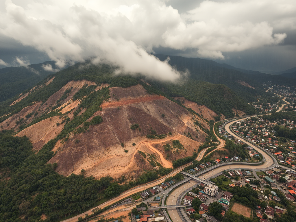
Cebu is not a flat province like Cavite or Laguna.
It is a mountain city with narrow slopes, rivers, steep terrain, coastal hazards, and protected watersheds.
Only about 25–30% of Cebu’s total land is actually suitable for safe residential development.
In other words:
The very formula used to compute Cebu’s housing demand does not fit Cebu’s geography.
It’s like measuring a mountain with a ruler designed for plains.
And because the method is wrong, the strategies that follow also fall apart.
So Where Will Cebu Build? The CLUP’s Answer: SRP
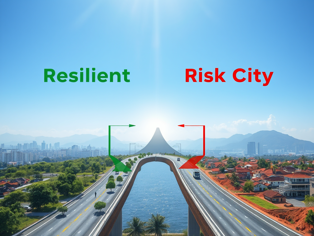
Because Cebu lacks large, flat, safe tracts of land, the CLUP turns almost entirely to the South Road Properties (SRP) — a reclaimed area exposed to storm surge, subsidence, and liquefaction — as the primary relocation site for the urban poor.
The City actually owns 313 hectares of land across 211 parcels.
But a massive 240 hectares (76%) of this land is in SRP.
This explains the CLUP’s insistence on building:
- Temporary housing in SRP
- Permanent high-rise housing in SRP
- Social housing clusters in SRP
SRP is the easiest to access politically.
But it is also one of the most dangerous places to house the poor.
Relocating families from riverbanks and hazard zones only to place them in a coastal hazard zone is not progress — it is risk transfer.
It moves people out of danger… and into another kind of danger.
The “Permanent Housing” Plan Is Even Harder to Believe
The CLUP describes an ambitious “South Coastal Urban Development” (SCUD) project:
- 5-storey, 10-storey, and 20-storey MRBs
- Long-term leases “like Singapore”
- Thousands of families relocated to high-density towers
But the proposed site is still underwater.
The land does not exist yet — it must be reclaimed first.
Even if the concept is good, the location and timing are not.
It will take years before the land is ready.
And billions upon billions before the buildings rise.
Which brings us to another uncomfortable truth.
The CLUP Claims ₱26 Billion Per Year for Housing — Cebu’s Budget Is Only ₱13 Billion
The CLUP states that the City is allocating ₱26 billion annually for MRB construction.
But Cebu City’s entire 2026 budget is only ₱13 billion.
Meaning:
- The housing plan requires twice the city’s entire budget
- No one knows where the money will come from
- No financing model, PPP structure, or national commitment is presented
It is a beautiful idea with no financial backbone.
Housing towers may be drawn on paper,
but they cannot be built with numbers that do not exist.
So Why Not Use the City’s Other Land?
Outside SRP, the City owns:
66.37 hectares
Used for schools, barangay halls, and urban poor housing.
These areas could be transformed into strategic mid-rise communities connected to jobs and transport.
But the CLUP does not propose land consolidation, urban regeneration, or vertical redevelopment.
6.79 hectares
Remain idle — mostly upland, steep, or constrained.
These lands are unsuitable for housing and should remain ecological buffers.
The Housing Plan Is Isolated — Not Integrated With Transport, Jobs, Commerce, or Water
Housing is not a standalone sector.
It must align with:
- transportation systems
- BRT corridors
- commercial centers
- industrial zones
- water supply
- hazard maps
- drainage systems
But Cebu’s housing plan exists in a silo.
It does not place housing near jobs.
It does not place housing near BRT stations.
It does not expand residential areas near commercial centers.
It does not address water scarcity for 865,000 new units.
It does not protect uplands from overdevelopment.
It does not calculate relocation impacts on transport or flooding.
It treats housing as if it floats above the city, unaffected by everything else.
That is not how cities work.
What We Are Left With Is a Housing Plan That Cannot Succeed
❌ The method is wrong for Cebu’s geography
❌ The land available does not match the land required
❌ The largest landholding (SRP) is hazard-prone
❌ The permanent housing site is underwater
❌ The budget is twice the city’s capability
❌ The plan does not integrate with transport, jobs, or water
❌ The uplands cannot support more sprawl
❌ The poor are relocated to isolation
This is not simply an imperfect plan.
It is a plan built on structural contradictions.
Cebu needs a housing strategy grounded in:
- vertical development
- transit-oriented planning
- safe, accessible locations
- integrated public land redevelopment
- financial realism
- environmental science
- climate resilience
The CLUP does not offer that.
Not yet.
What Comes Next in This Series
In the next articles, we’ll dive into:
Part 2 — Transport & Mobility: Where the CLUP Went Wrong
Why the BRT is disconnected from land use, and how transport planning became an afterthought.
Part 3 — Commercial & Industrial Zones: Misalignment and Missed Opportunities
A look at the political economy of zoning.
Part 4 — Environment, Flooding & Watersheds: The Consequences of Poor Planning
How upland mismanagement worsens lowland floods.
Part 5 — Governance, Variances & Loopholes: How the Zoning Board Can Override Everything
The silent powers shaping Cebu’s future.
This is the beginning of a deeper conversation —
one Cebu desperately needs.